Jump to content

File:Wembley Stadium Twin Towers.jpg

Page contents not supported in other languages.
This is a file from the Wikimedia Commons
From Wikipedia, the free encyclopedia
Wembley_Stadium_Twin_Towers.jpg (640 × 427 pixels, file size: 74 KB, MIME type: image/jpeg)

Summary

Description
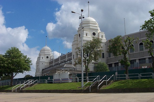
English: Wembley Stadium Twin Towers, London, England
Date Taken on 4 May 2002
Source From geograph.org.uk
Author Merv Payne
Permission
(Reusing this file)
Creative Commons Attribution Share-alike license 2.0
Attribution
(required by the license)
InfoField
Merv Payne / Wembley Stadium Twin Towers - shut down! / 
Merv Payne / Wembley Stadium Twin Towers - shut down!
Camera location51° 33′ 24.27″ N, 0° 17′ 05.54″ W  Heading=0° Kartographer map based on OpenStreetMap.View this and other nearby images on: OpenStreetMapinfo

Licensing

w:en:Creative Commons
attribution share alike
This file is licensed under the Creative Commons Attribution-Share Alike 2.0 Generic license.
Attribution:
Merv Payne
You are free:
  • to share – to copy, distribute and transmit the work
  • to remix – to adapt the work
Under the following conditions:
  • attribution – You must give appropriate credit, provide a link to the license, and indicate if changes were made. You may do so in any reasonable manner, but not in any way that suggests the licensor endorses you or your use.
  • share alike – If you remix, transform, or build upon the material, you must distribute your contributions under the same or compatible license as the original.

Captions

Wembley Stadium Twin Towers - shut down!
depicts<\/a>"}},"text\/plain":{"en":{"":"depicts"}}},"{\"value\":{\"entity-type\":\"item\",\"numeric-id\":43279,\"id\":\"Q43279\"},\"type\":\"wikibase-entityid\"}":{"text\/html":{"en":{"P180":"Wembley Stadium<\/a>"}},"text\/plain":{"en":{"P180":"Wembley Stadium"}}}}" class="wbmi-entityview-statementsGroup wbmi-entityview-statementsGroup-P180 oo-ui-layout oo-ui-panelLayout oo-ui-panelLayout-framed">
creator<\/a>"}},"text\/plain":{"en":{"":"creator"}}},"{\"value\":{\"entity-type\":\"property\",\"numeric-id\":2699,\"id\":\"P2699\"},\"type\":\"wikibase-entityid\"}":{"text\/html":{"en":{"":"URL<\/a>"}},"text\/plain":{"en":{"":"URL"}}},"{\"value\":\"https:\\\/\\\/www.geograph.org.uk\\\/profile\\\/12097\",\"type\":\"string\"}":{"text\/html":{"en":{"P2699":"https:\/\/www.geograph.org.uk\/profile\/12097<\/a>"}},"text\/plain":{"en":{"P2699":"https:\/\/www.geograph.org.uk\/profile\/12097"}}},"{\"value\":{\"entity-type\":\"property\",\"numeric-id\":2093,\"id\":\"P2093\"},\"type\":\"wikibase-entityid\"}":{"text\/html":{"en":{"":"author name string<\/a>"}},"text\/plain":{"en":{"":"author name string"}}},"{\"value\":\"Merv Payne\",\"type\":\"string\"}":{"text\/html":{"en":{"P2093":"Merv Payne"}},"text\/plain":{"en":{"P2093":"Merv Payne"}}},"{\"value\":{\"entity-type\":\"property\",\"numeric-id\":3831,\"id\":\"P3831\"},\"type\":\"wikibase-entityid\"}":{"text\/html":{"en":{"":"object of statement has role<\/a>"}},"text\/plain":{"en":{"":"object of statement has role"}}},"{\"value\":{\"entity-type\":\"item\",\"numeric-id\":33231,\"id\":\"Q33231\"},\"type\":\"wikibase-entityid\"}":{"text\/html":{"en":{"P3831":"photographer<\/a>"}},"text\/plain":{"en":{"P3831":"photographer"}}}}" class="wbmi-entityview-statementsGroup wbmi-entityview-statementsGroup-P170 oo-ui-layout oo-ui-panelLayout oo-ui-panelLayout-framed">
copyright status<\/a>"}},"text\/plain":{"en":{"":"copyright status"}}},"{\"value\":{\"entity-type\":\"item\",\"numeric-id\":50423863,\"id\":\"Q50423863\"},\"type\":\"wikibase-entityid\"}":{"text\/html":{"en":{"P6216":"copyrighted<\/a>"}},"text\/plain":{"en":{"P6216":"copyrighted"}}}}" class="wbmi-entityview-statementsGroup wbmi-entityview-statementsGroup-P6216 oo-ui-layout oo-ui-panelLayout oo-ui-panelLayout-framed">
source of file<\/a>"}},"text\/plain":{"en":{"":"source of file"}}},"{\"value\":{\"entity-type\":\"item\",\"numeric-id\":74228490,\"id\":\"Q74228490\"},\"type\":\"wikibase-entityid\"}":{"text\/html":{"en":{"P7482":"file available on the internet<\/a>"}},"text\/plain":{"en":{"P7482":"file available on the internet"}}},"{\"value\":{\"entity-type\":\"property\",\"numeric-id\":973,\"id\":\"P973\"},\"type\":\"wikibase-entityid\"}":{"text\/html":{"en":{"":"described at URL<\/a>"}},"text\/plain":{"en":{"":"described at URL"}}},"{\"value\":\"https:\\\/\\\/www.geograph.org.uk\\\/photo\\\/357819\",\"type\":\"string\"}":{"text\/html":{"en":{"P973":"https:\/\/www.geograph.org.uk\/photo\/357819<\/a>"}},"text\/plain":{"en":{"P973":"https:\/\/www.geograph.org.uk\/photo\/357819"}}},"{\"value\":{\"entity-type\":\"property\",\"numeric-id\":137,\"id\":\"P137\"},\"type\":\"wikibase-entityid\"}":{"text\/html":{"en":{"":"operator<\/a>"}},"text\/plain":{"en":{"":"operator"}}},"{\"value\":{\"entity-type\":\"item\",\"numeric-id\":1503119,\"id\":\"Q1503119\"},\"type\":\"wikibase-entityid\"}":{"text\/html":{"en":{"P137":"Geograph Britain and Ireland<\/a>"}},"text\/plain":{"en":{"P137":"Geograph Britain and Ireland"}}},"{\"value\":{\"entity-type\":\"property\",\"numeric-id\":7384,\"id\":\"P7384\"},\"type\":\"wikibase-entityid\"}":{"text\/html":{"en":{"":"geograph.org.uk image ID<\/a>"}},"text\/plain":{"en":{"":"geograph.org.uk image ID"}}},"{\"value\":\"357819\",\"type\":\"string\"}":{"text\/html":{"en":{"P7384":"357819<\/a>"}},"text\/plain":{"en":{"P7384":"357819"}}}}" class="wbmi-entityview-statementsGroup wbmi-entityview-statementsGroup-P7482 oo-ui-layout oo-ui-panelLayout oo-ui-panelLayout-framed">
inception<\/a>"}},"text\/plain":{"en":{"":"inception"}}},"{\"value\":{\"time\":\"+2002-05-04T00:00:00Z\",\"timezone\":0,\"before\":0,\"after\":0,\"precision\":11,\"calendarmodel\":\"http:\\\/\\\/www.wikidata.org\\\/entity\\\/Q1985727\"},\"type\":\"time\"}":{"text\/html":{"en":{"P571":"4 May 2002"}},"text\/plain":{"en":{"P571":"4 May 2002"}}}}" class="wbmi-entityview-statementsGroup wbmi-entityview-statementsGroup-P571 oo-ui-layout oo-ui-panelLayout oo-ui-panelLayout-framed">

4 May 2002

coordinates of the point of view<\/a>"}},"text\/plain":{"en":{"":"coordinates of the point of view"}}},"{\"value\":{\"latitude\":51.556741,\"longitude\":-0.284872,\"altitude\":null,\"precision\":1.0e-6,\"globe\":\"http:\\\/\\\/www.wikidata.org\\\/entity\\\/Q2\"},\"type\":\"globecoordinate\"}":{"text\/html":{"en":{"P1259":"51\u00b033&apos;24.268&quot;N, 0\u00b017&apos;5.539&quot;W"}},"text\/plain":{"en":{"P1259":"51\u00b033'24.268\"N, 0\u00b017'5.539\"W"}}},"{\"value\":{\"entity-type\":\"property\",\"numeric-id\":7787,\"id\":\"P7787\"},\"type\":\"wikibase-entityid\"}":{"text\/html":{"en":{"":"heading<\/a>"}},"text\/plain":{"en":{"":"heading"}}},"{\"value\":{\"amount\":\"+0\",\"unit\":\"http:\\\/\\\/www.wikidata.org\\\/entity\\\/Q28390\"},\"type\":\"quantity\"}":{"text\/html":{"en":{"P7787":"0 degree<\/span>"}},"text\/plain":{"en":{"P7787":"0 degree"}}}}" class="wbmi-entityview-statementsGroup wbmi-entityview-statementsGroup-P1259 oo-ui-layout oo-ui-panelLayout oo-ui-panelLayout-framed">

51°33'24.268"N, 0°17'5.539"W

heading: 0 degree
exposure time<\/a>"}},"text\/plain":{"en":{"":"exposure time"}}},"{\"value\":{\"amount\":\"+0.00142857142857142857\",\"unit\":\"http:\\\/\\\/www.wikidata.org\\\/entity\\\/Q11574\"},\"type\":\"quantity\"}":{"text\/html":{"en":{"P6757":"0.00142857142857142857 second<\/span>"}},"text\/plain":{"en":{"P6757":"0.00142857142857142857 second"}}}}" class="wbmi-entityview-statementsGroup wbmi-entityview-statementsGroup-P6757 oo-ui-layout oo-ui-panelLayout oo-ui-panelLayout-framed">

0.00142857142857142857 second

f-number<\/a>"}},"text\/plain":{"en":{"":"f-number"}}},"{\"value\":{\"amount\":\"+6.7\",\"unit\":\"1\"},\"type\":\"quantity\"}":{"text\/html":{"en":{"P6790":"6.7"}},"text\/plain":{"en":{"P6790":"6.7"}}}}" class="wbmi-entityview-statementsGroup wbmi-entityview-statementsGroup-P6790 oo-ui-layout oo-ui-panelLayout oo-ui-panelLayout-framed">
focal length<\/a>"}},"text\/plain":{"en":{"":"focal length"}}},"{\"value\":{\"amount\":\"+7.8\",\"unit\":\"http:\\\/\\\/www.wikidata.org\\\/entity\\\/Q174789\"},\"type\":\"quantity\"}":{"text\/html":{"en":{"P2151":"7.8 millimetre<\/span>"}},"text\/plain":{"en":{"P2151":"7.8 millimetre"}}}}" class="wbmi-entityview-statementsGroup wbmi-entityview-statementsGroup-P2151 oo-ui-layout oo-ui-panelLayout oo-ui-panelLayout-framed">

7.8 millimetre

media type<\/a>"}},"text\/plain":{"en":{"":"media type"}}},"{\"value\":\"image\\\/jpeg\",\"type\":\"string\"}":{"text\/html":{"en":{"P1163":"image\/jpeg"}},"text\/plain":{"en":{"P1163":"image\/jpeg"}}}}" class="wbmi-entityview-statementsGroup wbmi-entityview-statementsGroup-P1163 oo-ui-layout oo-ui-panelLayout oo-ui-panelLayout-framed">

image/jpeg

geograph.org.uk image ID<\/a>"}},"text\/plain":{"en":{"":"geograph.org.uk image ID"}}},"{\"value\":\"357819\",\"type\":\"string\"}":{"text\/html":{"en":{"P7384":"357819<\/a>"}},"text\/plain":{"en":{"P7384":"357819"}}}}" class="wbmi-entityview-statementsGroup wbmi-entityview-statementsGroup-P7384 oo-ui-layout oo-ui-panelLayout oo-ui-panelLayout-framed">
instance of<\/a>"}},"text\/plain":{"en":{"":"instance of"}}},"{\"value\":{\"entity-type\":\"item\",\"numeric-id\":125191,\"id\":\"Q125191\"},\"type\":\"wikibase-entityid\"}":{"text\/html":{"en":{"P31":"photograph<\/a>"}},"text\/plain":{"en":{"P31":"photograph"}}}}" class="wbmi-entityview-statementsGroup wbmi-entityview-statementsGroup-P31 oo-ui-layout oo-ui-panelLayout oo-ui-panelLayout-framed">
coordinates of depicted place<\/a>"}},"text\/plain":{"en":{"":"coordinates of depicted place"}}},"{\"value\":{\"latitude\":51.55666525223194,\"longitude\":-0.27968075332618436,\"altitude\":null,\"precision\":0.0001,\"globe\":\"http:\\\/\\\/www.wikidata.org\\\/entity\\\/Q2\"},\"type\":\"globecoordinate\"}":{"text\/html":{"en":{"P9149":"51\u00b033&apos;24.1&quot;N, 0\u00b016&apos;46.9&quot;W"}},"text\/plain":{"en":{"P9149":"51\u00b033'24.1\"N, 0\u00b016'46.9\"W"}}}}" class="wbmi-entityview-statementsGroup wbmi-entityview-statementsGroup-P9149 oo-ui-layout oo-ui-panelLayout oo-ui-panelLayout-framed">

51°33'24.1"N, 0°16'46.9"W

location of creation<\/a>"}},"text\/plain":{"en":{"":"location of creation"}}},"{\"value\":{\"entity-type\":\"item\",\"numeric-id\":207201,\"id\":\"Q207201\"},\"type\":\"wikibase-entityid\"}":{"text\/html":{"en":{"P1071":"London Borough of Brent<\/a>"}},"text\/plain":{"en":{"P1071":"London Borough of Brent"}}}}" class="wbmi-entityview-statementsGroup wbmi-entityview-statementsGroup-P1071 oo-ui-layout oo-ui-panelLayout oo-ui-panelLayout-framed">
data size<\/a>"}},"text\/plain":{"en":{"":"data size"}}},"{\"value\":{\"amount\":\"+75754\",\"unit\":\"http:\\\/\\\/www.wikidata.org\\\/entity\\\/Q8799\"},\"type\":\"quantity\"}":{"text\/html":{"en":{"P3575":"75,754 byte<\/span>"}},"text\/plain":{"en":{"P3575":"75,754 byte"}}}}" class="wbmi-entityview-statementsGroup wbmi-entityview-statementsGroup-P3575 oo-ui-layout oo-ui-panelLayout oo-ui-panelLayout-framed">

75,754 byte

height<\/a>"}},"text\/plain":{"en":{"":"height"}}},"{\"value\":{\"amount\":\"+427\",\"unit\":\"http:\\\/\\\/www.wikidata.org\\\/entity\\\/Q355198\"},\"type\":\"quantity\"}":{"text\/html":{"en":{"P2048":"427 pixel<\/span>"}},"text\/plain":{"en":{"P2048":"427 pixel"}}}}" class="wbmi-entityview-statementsGroup wbmi-entityview-statementsGroup-P2048 oo-ui-layout oo-ui-panelLayout oo-ui-panelLayout-framed">

427 pixel

width<\/a>"}},"text\/plain":{"en":{"":"width"}}},"{\"value\":{\"amount\":\"+640\",\"unit\":\"http:\\\/\\\/www.wikidata.org\\\/entity\\\/Q355198\"},\"type\":\"quantity\"}":{"text\/html":{"en":{"P2049":"640 pixel<\/span>"}},"text\/plain":{"en":{"P2049":"640 pixel"}}}}" class="wbmi-entityview-statementsGroup wbmi-entityview-statementsGroup-P2049 oo-ui-layout oo-ui-panelLayout oo-ui-panelLayout-framed">

640 pixel

checksum<\/a>"}},"text\/plain":{"en":{"":"checksum"}}},"{\"value\":\"c9455ee0ef83f4e395bd658b6432abf473e08e08\",\"type\":\"string\"}":{"text\/html":{"en":{"P4092":"c9455ee0ef83f4e395bd658b6432abf473e08e08"}},"text\/plain":{"en":{"P4092":"c9455ee0ef83f4e395bd658b6432abf473e08e08"}}},"{\"value\":{\"entity-type\":\"property\",\"numeric-id\":459,\"id\":\"P459\"},\"type\":\"wikibase-entityid\"}":{"text\/html":{"en":{"":"determination method or standard<\/a>"}},"text\/plain":{"en":{"":"determination method or standard"}}},"{\"value\":{\"entity-type\":\"item\",\"numeric-id\":13414952,\"id\":\"Q13414952\"},\"type\":\"wikibase-entityid\"}":{"text\/html":{"en":{"P459":"SHA-1<\/a>"}},"text\/plain":{"en":{"P459":"SHA-1"}}}}" class="wbmi-entityview-statementsGroup wbmi-entityview-statementsGroup-P4092 oo-ui-layout oo-ui-panelLayout oo-ui-panelLayout-framed">

c9455ee0ef83f4e395bd658b6432abf473e08e08

File history

Click on a date/time to view the file as it appeared at that time.

Date/TimeThumbnailDimensionsUserComment
current11:03, 14 January 2010Thumbnail for version as of 11:03, 14 January 2010640 × 427 (74 KB)Seth Whales== {{int:filedesc}} == {{Information |Description={{en|1=Wembley Stadium Twin Towers, London, England}} |Source=From [http://www.geograph.org.uk/photo/357819 geograph.org.uk] |Date=2002-05-04 |Author=[http://www.geograph.org.uk/profile/12097 Merv Payne] |

More than 100 pages use this file. The following list shows the first 100 pages that use this file only. A full list is available.

View more links to this file.

Global file usage

The following other wikis use this file:

View more global usage of this file.

Metadata